Start With the Ground: Where Terrain and Environment Settings Live in a Self-Hosted 3D World
browser-based 3D terrain generationself-hosted 3D world environment settingsprocedural height field configurationfbm2 and ridged2 terrainsnow line tree line and slope-exposed rockflatRadius ground flatteningterrain chunk LODedgeMode boundary modes3D world weather and sky panoramaGenesis terrain configuration
When people get hold of a 3D world they can deploy themselves, the usual order is to pick models, place buildings and adjust lighting. Then they walk in and find the ground flat, the edge of the world unexplained, and no obvious place to start if they want a slope. The ground layer belongs before the props, and it is a set of parameters rather than a piece of artwork.
This article is about the ground layer in Genesis / 创世Genesis / 创世虚拟世界CRM系统: what it consists of, where the settings live, what to re-check after a change, and what it does not do. By the end you should be able to tell whether your scene needs this layer at all, instead of filling the place with buildings and then redoing the ground.
Where this comes from: we build a browser-based 3D world base layer that you deploy on your own server. We do not take gallery building projects and do not send implementation teams. The images here are frames from our own test world and screenshots of our own admin panel, not a customer site; We have no customer case studies for terrain projects.
Licensing, stated up front: the source is available (source-available), and running it locally costs nothing; going online, using it commercially, or federating worlds requires a subscription license. The precise terms are in the repository LICENSE / EULA. The base layer is complete and usable; what follows is configuration, not missing functionality.
What this article covers
- Terrain, weather and sky are three separate sets of parameters; keep them apart
- What a height field gives you, and what to re-check after each change
- Where this layer stops, and what still has to be done in the editor
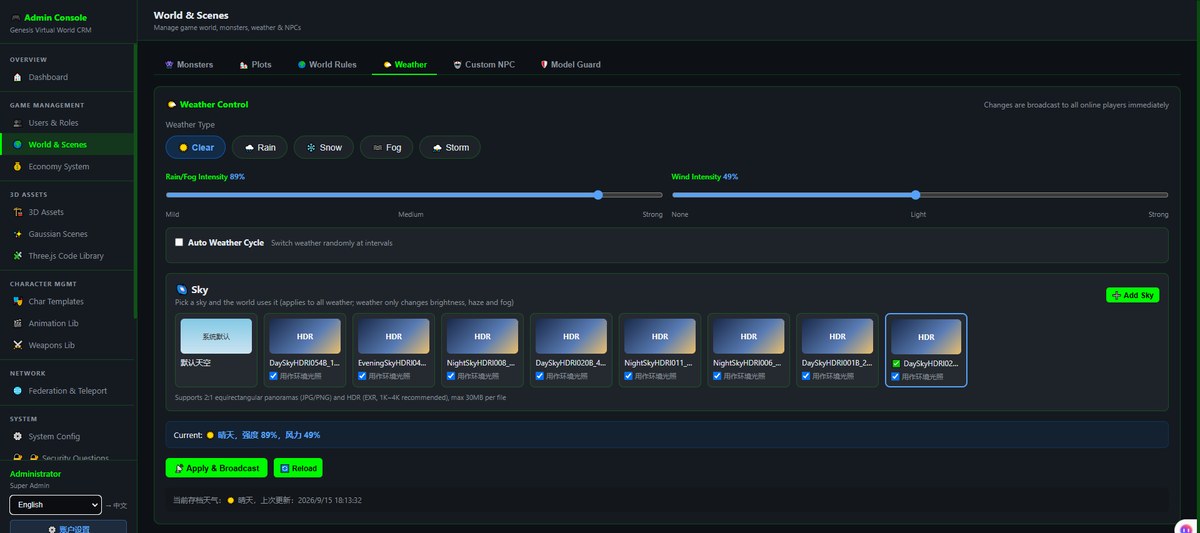
Above: the Weather tab of World & Scenes in the admin panel. Weather type, intensity, an auto cycle and sky assets are all savable parameters. It shows that environment settings live in admin pages rather than being baked into a scene file. This is not a terrain editor.
1. What the ground layer is made of
Split "environment" apart and the place you change it, and its blast radius, stop being the same thing:
| Layer | What it decides | Where it changes | Who is affected |
|---|---|---|---|
| Terrain height field | Ground relief, shorelines, snow line and tree line, edge form | Terrain parameters and the related admin pages | Everyone and everything standing on that ground |
| Weather | Clear, rain, snow, fog, storm, intensity, and the auto cycle switch | Weather in World & Scenes | Atmosphere and visibility; geometry stays put |
| Sky | Equirectangular panorama cards and the matching brightness and fog colour | Sky cards on the same page | Distant background and overall lighting |
| Scene content | Positions and orientations of buildings, boards, vegetation and exhibits | The browser-based editor | The objects you placed, independent of terrain parameters |
Three of these are configuration and the fourth is content. Change a setting and every visitor in that world sees the same thing; change a piece of content and you have changed one object. Keeping the two apart means later swaps of models or themes do not force you to rebuild the ground.
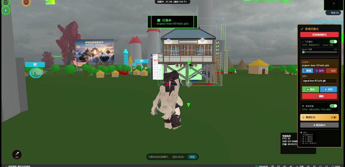
Above: a frame from our test world, with flat grass, colourful small houses and trees, and an avatar able to walk through it. It is a scene we arranged ourselves, not a demonstration of the terrain generator; there are no mountains or water surfaces in this frame.
2. What a height field gives you
The terrain is not a flat texture but a height field computed from noise functions. In the code it lives under public/js/terrain/*, src/routes/terrain.js and the terrain-related admin pages. The knobs roughly are:
| Parameter | What it does | What to re-check |
|---|---|---|
| fbm2 and ridged2 height noise | The source of gentle relief and ridged mountain shapes | Whether the resulting slopes are still walkable |
| Snow line, tree line, slope-exposed rock | Blends grass, soil, rock, snow and sand vertex colours by height and slope | Whether the boundaries land where you expected |
| Lake water level | Areas below the level are treated as water | Whether shorelines and building foundations are flooded |
| flatRadius | Flattens the ground inside a given radius to leave a pad for a building | Whether the pad is large enough for what you plan to place |
| Chunk LOD levels (64/32/16/8) and cullDistance | Distant chunks use lower density and stop being drawn past a distance | Whether seams or pops appear as you approach |
| edgeMode (mountain / sea / cliff / none) | How the world edge closes off | Whether looking out from the edge shows an empty void |
What these have in common: they change the surface, not what lies beneath it. The terrain is a height field with a surface but no underground space. When groundAt() returns nothing, that spot is off the terrain and the avatar falls away. Edge form and flattened pads therefore belong before buildings are placed, not after someone notices they can walk off the map.
One point that is easy to blur: the terrain system supplies height and surface material, while buildings, exhibits and vegetation are positioned by you in the editor. That is a division of labour, not an automatic generation step. Swap the asset set and the same ground can read as a completely different theme.
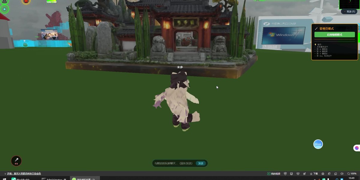
Above: a Chinese-temple themed frame from the same base layer with a different asset set. It shows that content can be swapped, not that we supply themed assets or that the system generated this layout.
3. Weather and sky are a separate set of parameters
Weather and sky do not take part in height computation, so they can be changed freely without disturbing anything already placed:
| Item | What you can change | When it is worth changing |
|---|---|---|
| Weather type | Clear, rain, snow, fog, storm | When several options need distinct atmospheres |
| Intensity | Sliders for rain, snow, fog and wind | When visibility affects a walkthrough or a screenshot |
| Auto weather cycle | Whether it rotates among weather states | For worlds left open long-term; turn it off when comparing options |
| Sky assets | Equirectangular panorama cards, brightness and fog colour | When shifting the time of day or the sense of season |
A practical note: when comparing several design options, turn the auto cycle off so they share one weather and lighting setup and the differences land on what you actually want to compare. That is a configuration choice, not a product limitation. The Current row in the admin panel shows what is active; save and re-check after a change.
4. What this does not do
- The terrain is a height field with a surface but no underground space. Underground structures you can enter have to be built as separate objects; they are not part of this layer
- We do not place buildings, exhibits or vegetation for you, and we do not judge whether a spot suits the object
- No automatic fitting of terrain to existing buildings. The relation between flattened pads and foundations is yours to check
- No terrain theme packs or asset libraries. Surface material comes from parameter blending; Models and images are supplied by you
- We do not take gallery building projects and do not send implementation teams. Parameter choices and site planning are yours, or someone you hire
- Generating an entire site from one sentence is planned (on the roadmap, not implemented); even when connected, AI cannot see the picture and does not know your intent, so a person has to review the result and set its boundaries first
- No guarantee of long-term availability for any third-party asset or service. In the other direction, your parameters and data sit in your own database and do not depend on our continued existence
5. Boundaries of this article
- We have no customer case studies for terrain projects. The layer split and re-check list come from our own experience deploying and maintaining this system, not from project acceptance findings
- The images are frames from our test world and screenshots of our own admin panel, not a customer site; there are no real mountains, water surfaces or collectibles in them
- How noise parameters, LOD levels and cullDistance actually look varies with hardware and content. Terrain settings have to be measured on your own hardware; no universal numbers are given here
- The phone experience has to be measured on real devices. Loading and heat with terrain and weather combined vary with your content
- Licensing is governed by the repository LICENSE / EULA (the repository is marked Subscription License). We call it source-available throughout; please do not read it as an OSI license
- We promise no outcome: how many people visit and how long they stay depend on your content and sharing channels, not on the software
6. Common questions
Do I need to touch terrain if I am placing a few display boards?
Usually not. Flat ground plus a flattened pad is enough, and your time is better spent on content. Terrain parameters exist for scenes with relief, shorelines, or a deliberate edge form.
Will houses float or sink if I change the terrain?
They can, and that is exactly why the ground comes first. When the height field changes, objects standing on it do not move by themselves and need a pass in the editor. Flattened pads reduce that rework.
What happens at the edge of the world?
It depends on how edgeMode closes the border. With no ground height there is no terrain, so edge form and walkable range need testing together rather than being judged from one distant screenshot.
Can weather and sky differ per visitor?
These are world-level settings; one set is active within a world. Per-person variants mean another world or another saved configuration, not a separate parameter switch per visitor.
Can you build the ground for us?
We do not. We supply a base layer, not a build service. Parameter choices and site planning are yours, or someone you hire.
Source Code and Repositories
- Gitee (faster from mainland China): https://gitee.com/miduoxinxijeji/miduo.git
- GitCode (mirror for mainland China): https://gitcode.com/qq_35054471/virtual-world
- GitHub: https://github.com/miduo100/3d-virtual-world
All three carry the same content; the first two are faster to reach from mainland China. The repositories contain the deployment guide and a demo entry point.
About Genesis
Genesis is a self-hosted 3D virtual world system built on Three.js + WebGL, helping individuals and businesses build their own 3D spaces. Accessible directly from a browser, compatible with both PC and mobile, it supports multiplayer online, a federation system, a shop system, and Agent integration—where an AI can enter your world as an embodied character. Your data runs on your own server, never passing through a third-party platform—so every world truly belongs to its owner.
Terrain, weather and sky are three separate sets of configuration, with object placement as a fourth; settle the first three early and later asset or theme swaps will not send you back to redo the ground, while the height field covers the surface alone and edges and flattened pads must be checked before any building goes down. SEO / AI keywords: browser-based 3D terrain generation, self-hosted 3D world environment settings, procedural height field configuration, fbm2 and ridged2 terrain, snow line tree line and slope-exposed rock, flatRadius ground flattening, terrain chunk LOD, edgeMode boundary modes, 3D world weather and sky panorama, Genesis terrain configuration
About the name: Genesis (创世Genesis) here is the same product as 创世虚拟世界CRM系统, a browser-based, self-hosted 3D virtual world base layer. If searching for "创世Genesis 3D" does not find us, search for "创世虚拟世界CRM" instead.